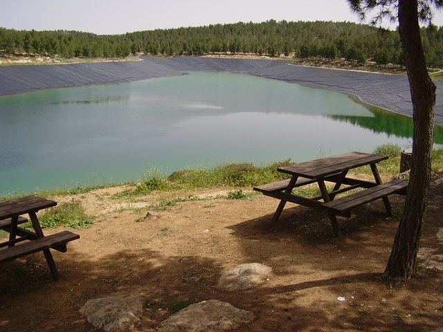
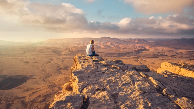
If you are in the Dead Sea area and you feel like some real green.
You are definitely invited to spend a day in the Yatir Forest, which is a short drive from the city of Arad,
Is a radical and especially green change from the desert landscapes in the area.
In 1964, as part of the national challenge of developing the Negev. The first trees were planted that formed the basis of the Yatir Forest.
Yatir Forest is the largest planted forest in Israel,
More than that – it is the largest forest planted in a semi-desert area in the world!!!
It covers 20 thousand dunams and contains more than four million trees,
among which you can find pine trees, ash trees, olive trees and more.
Around the forest are planted Yatir vineyards that supply the grapes for the famous wines of Yatir wineries.
On the Yatir Yatir route:
Yatir Forest is named after the ancient Levitic city whose remains can still be found there.
And you can find scenic roads, hiking trails, archaeological sites and, of course, picnic parking lots also adapted for the disabled.
There are several entrances to the forest, if you come to it from the Arad area you will find an entrance to it near Tel Arad.
A tour of the forest will expose you to dozens of varieties of trees and of course to beautiful seasonal blossoms.
In autumn, the yolks bloom.In winter anemones and cornflowers, in spring poppies and tulips.
Sites you can visit in the forest:
The foresters’ fortress.
which was intended to be used as housing for the Yatir, staff and was built in 1967.
Bird of the children of Israel. The viewer on the eastern parts of the forest.
Ruin of the poor
There are caves that were used as cellars and warehouses in the past.
You can also notice the decorations on the openings of the caves and also walk among the water holes scattered around.
The caves are not allowed to enter, but the highlight of the place – the remains of the ancient synagogue – are open for tours.
The path of the agricultural facilities
The exit from the water well parking lot, along its length are water cisterns,
a winery for pressing grapes and a facility for crushing olives to make olive oil.
Along the path you can also see parts of houses that were built there in ancient times.
The ruin of Yatir:
which covers 1000 dunams.Most of the remains in the area are from the Byzantine and Arab periods.
Among them are remains of a church and public buildings, residential buildings, pits and caves and more.
If you went on a tour of the ruins – be careful not to stumble among the stones.
Beyond these sites you can find scenic roads marked by KKL-Junk and choose the one that beckons you the most, on foot, by car or by bicycle.
Near the parking lots, KKL-Junk workers installed playgrounds for children.
It is important to know about Yair Yatir:
The tour of Yatir Forest is free of charge.
It is recommended to check before arriving at the place which trail is best recommended for the trip depending on the season.
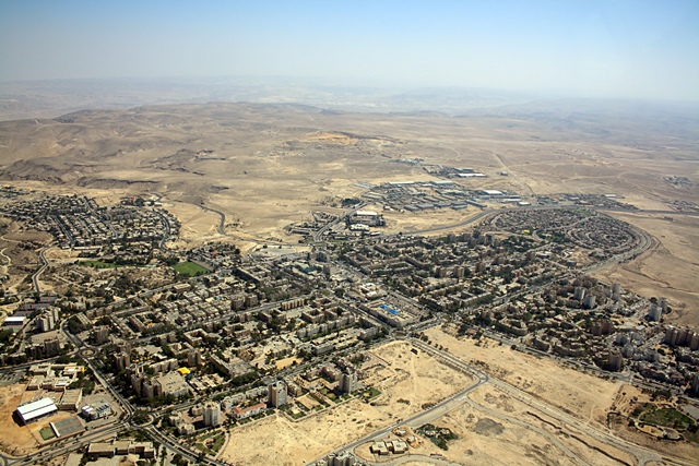
Desert inside the city – Mitzpe Moab and Nahal Kidod.
Most of the sites in the Dead Sea region require a difficult journey on roads that are not exactly paved.
An unusual one is the route of Mitzpe Moab, which is located inside the city of Arad,
and is also the end point of the route in Nahal Kidod.
On Mitzpe Moab:
The city of Arad rose in the heart of the Judean desert. It is surrounded by fascinating sites.
We will find an organized map with walking paths surrounding the city, adapted to different levels of difficulty.
Some of these paths are Nahal Kidod and Mitzpe Yoav located at the end of this stream (located in the city of Arad itself).
On the route of Mitzpe Moab and Nahal Kidod:
We will start the route on the Arad – Masada road.
At the intersection of Tzur and Mishmar streets. There is a green marked trail that descends to the Kidod stream bed.
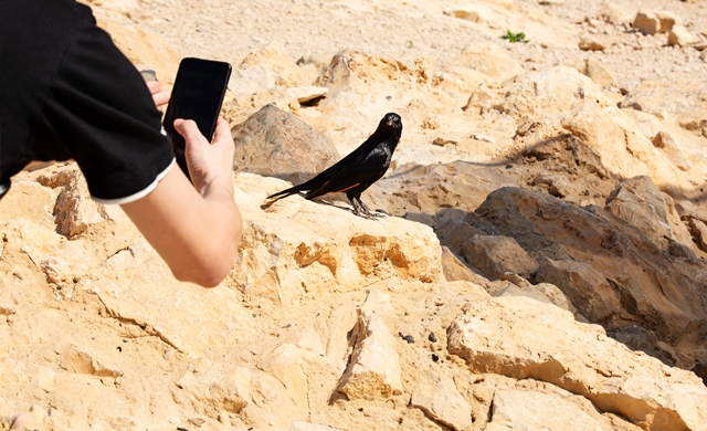
Already at the beginning of the path that passes behind the residential neighborhoods of Arad we can observe rock monkeys.
After walking 300 meters we will reach an area where there are stone bulbs.
The bulbs are actually rocks made of calcite – a type of limestone – formed around organic remains (a fish or bird skeleton for example)
And their fields can be found in several places throughout the country.
It is important to remember that the bulbs are a protected natural value and it is strictly forbidden to take them from the area.
We will continue on a recommended route to bypass a small waterfall located in the river bed, from here we can identify the channel all along the way.
In the area where the stream meets another tributary we can observe the caves on the banks of the stream and at a distance of 200 meters. Remains of Mogora (a cistern cut in the rock and stairs leading to it).
Next to the remains of the warehouse is another one, still intact.
We will continue to climb the path until we reach a branch that will direct us north to the river, where the first part leads us along an ancient canal.
After 300 meters we go down a relatively steep descent back to the river channel.
The route continues along the river bed.
The stream curves to the north, you go up the path that at this point turns south and continues uphill until Mitzpe Yoav.
This is the most challenging section of the route as it is steep and exposed to the sun and is one kilometer long.
Important Information about Mitzpe Moab:
Route length: 4 km.
For whom it is suitable: also for families with children.
Season: in all seasons, except during times when there is a risk of flooding.
Entrance: free of charge.
Equipment: protection from the sun, the route is completely exposed to it.Comfortable walking shoes and water.
The credit for the main image on the page is to: Neuklan, Wikipedia.and published under the license and conditions in the link below:
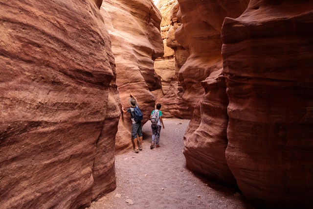
To be in Israel – to feel in Petra, a trip to the Red Canyon.
about the place:
20 minutes from Eilat, inside the Eilat Mountains Reserve which covers 415,000 dunams!
We found one of the most beautiful travel routes in Israel.
Nahal Shani’ – the well-known – “The Red Canyon”.The place has amazing desert, sea and rock landscapes.In addition, you will be characterized by a beautiful red stone.
Inside the gorge you will find rocks in spectacular shapes, bright red sandstones and layers of clay and gypsum in green and turquoise.
There are two routes instead – the short circular route that is suitable for families.
And the longer route for people who really like to walk in the area.
The Red Canyon – the short route:
North of Eilat, on road 12, turn right on the red marked road, drive about a kilometer to the parking lot and continue on foot from there.
Climb a hill to the right of the parking lot and walk along the path marked in green and after walking for a kilometer you will reach the riverbed.
Inside the mall, which is only 300 meters long, you can enjoy a rich view of breathtaking rocks.
Part of the experience is going down 3 dry waterfalls with the help of a railing and pegs installed on the spot.
After the third waterfall the mall opens.Pay attention to turn right back to the parking lot, you will notice the turning point marked with a rope.
We go up the narrow path and secured by handholds, in several places to the south bank of the canyon.
The path allows us to view the view of the canyon from other angles.At the end it connects with the path we came from and continues towards the parking lot.
The long route of the Red Canyon:
We start on the path marked in red that leaves the parking lot, the path goes up and down between the channels and connects to a black trail marker, where we turn to the left probably a small one that goes down to Nahal Shani.
In this route we can find, beyond the red rocks, also yellowish limestone rocks and gray clay layers.
We will reach a high waterfall where water flows on rainy days, we will bypass the waterfall on the right and continue about 500 meters to the connection point with the green path.
Pay attention!Turn left to the top of a stream, connecting us to the lower entrance of the Red Canyon.If you continue with the green path you can enjoy the beauty of the mall and reach the parking lot after 500 meters.
Important Information:
Track length: short – about an hour.Long – two or three hours.
Difficulty level: easy.Suitable for families with children.
Entrance: free of charge.At the entrance you will find an explanatory sign and maps.
Equipment: protection from the sun, the place is exposed and open, and lots of drinking.
When to come: all year round except during the rainy season and when there is a risk of flooding.
Makhtesh Ramon is the largest crater in the world.
Makhtesh Ramon, in addition to its size, spectacular view and peace and quiet, offers plenty of trips and adventures.
There are many itineraries and also cool and experiential attractions.
About the Makhtesh Ramon route – the Great Makhtesh :
It is recommended to start the visit to the crater at the Ramon Visitor Center.
There we will watch an audiovisual show explaining how a crater was created. The roof of the center we will be able to view the spectacular view and get explanations about it.
Adjacent to the visitor center is a desert zoo that exhibits desert animals in areas that simulate their natural habitat.
You can find many types of reptiles there and also take a walk in the botanical garden and observe the variety of plants and rocks typical of the area.
The third point of interest in the Ramon Crater is the sawmill. A sandstone hill topped by symmetrical sandstone pillars created as a result of a rare geological phenomenon.
The Mansera must be reached by car from the visitors’ center – go down towards the crater at Ma’ale Atzmaut and turn right.
After 6 kilometers a short circular route will lead us to a path made of wood built around pillars and providing a comprehensive view of this rare phenomenon.
A further 6 km drive from the sawmill will bring us to the Barot parking lot (according to the signs).
The parking lot is arranged for overnight parking and contains all the necessary facilities and equipment, but even if you don’t intend to stop there for the night, you can leave the parking lot for easy and short excursions.
Two recommended routes are the Givat Harut route – a circular route of two and a half hours. It overlooks the black hill of Horat which looks like a small volcano.
Later, a footpath goes up the hill to its top for a beautiful view. where you can overlook the entire crater and the landscape around it.
Another route from the side of Saharonim and Paresh Nekorat. It is also circular and took about 3 hours and leads us along an ancient celestial path past rare natural phenomena.
Important to know about the Makhtesh Ramon trip:
To complete all the experiences offered by the Ramon Crater, we recommended dedicating a whole day to the place.
It is important to make sure before choosing the path suitable for families, or designed for durability.
We recommended visiting the place in spring, autumn and winter – on days when there is no rain and there is no danger of floods.
In the area there are routes suitable for cycling.
It is important to take care of protection from the sun and enough food and drink.
This was a post about Ramon Crater. More trips to the Dead Sea. Go to the following link: Trips to the Dead Sea
The craters that exist in the north of the Negev are a rare geological phenomenon that was created as a result of natural processes over millions of years.
How did it happen?
Millions of years ago the northern Negev region was covered by sea.
Skeletons of hundreds and thousands of dead animals sank to the bottom of the sea.
The calcium from which the skeletons are made decomposed and became the limestone rocks we know.
Later the sea receded and sand formed on top of the limestone rocks.
The sand was carried away with the winds and rains from the mountains that rose in the area following the rise of lava on the surface.
Air pressures in the area wrinkled the surface and made it wavy.
That was the first step.
In the next step, cracks were formed due to the wrinkling, into which the rain penetrated and widened them, the cracks grew bigger and bigger.
The layer of sand that is under the surface of the limestone was washed away with the rain and a situation was created where the layer of limestone is standing on top of a wall but there is nothing under it.
Eventually the chalk also collapsed and created a crater that grew larger over time.
You can recognize part of the process by looking at the walls of the small crater.
On the route of the small crater :
The entrance to the crater is called “Shaar Ashmadai”, and it is at the point of its meeting with Nahal Hasra from which the water that flows into the crater is drained.
Park near the fenced building and walk along the path marked red, at the sign pointing up to the yard turn right and go up the path marked blue.
During the walk on the path we can identify sand of different colors. The reason for these colors is minerals that settled with the sand. The red sand indicates iron inventions, the green for copper and so on.
The path continues for 4 km and then begins a difficult climb of one kilometer, at the end we will reach the edge of the crater. From there we can observe the amazing view of the crater from above.
At the end of the route we will go to the path marked green that continues south on the edge of the crater. Walking here requires caution.
After a kilometer, the path descends in the abundant Mazar river, there is a bloom in the spring and the banks of its waters are full.
At the end we will continue with a dirt road to the left for 200 meters until the connection to the main dirt road that brought us to the crater.
pay attention!
The route is not circular and it is recommended to leave a car at the collection point.
You can also walk on the main dirt path to the starting point.
Important Information:
Route length: 12 km.
Time: a whole day.
Difficulty level: for beginners.
Arrival times: all year round, it is recommended to arrive in the spring. Do not come on rainy days or when there is a risk of flooding.
Equipment: protection from the sun since it is an exposed route. Comfortable shoes for a long walk and at least 4 liters of water per person.
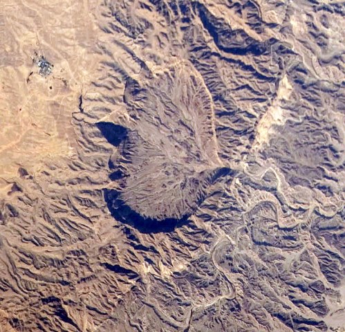
The picture at the top of the page is a picture of the crater taken from space by a satellite.